Yarlung Tsangpo Grand Canyon
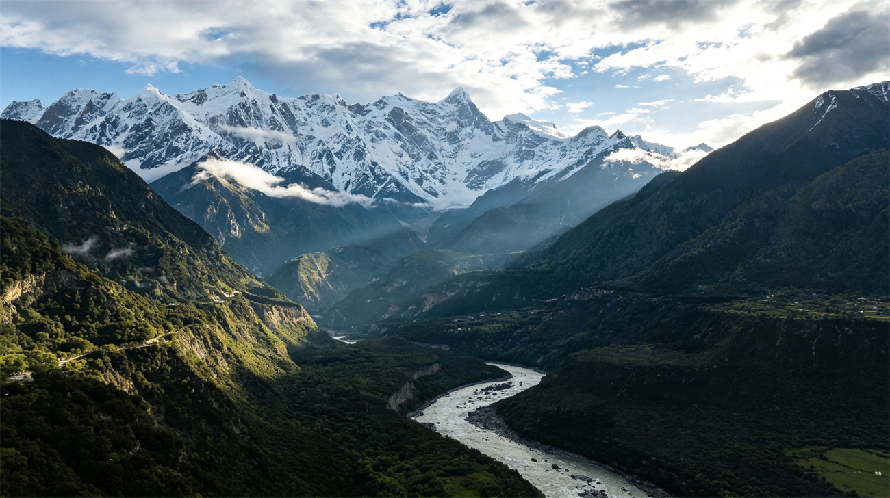
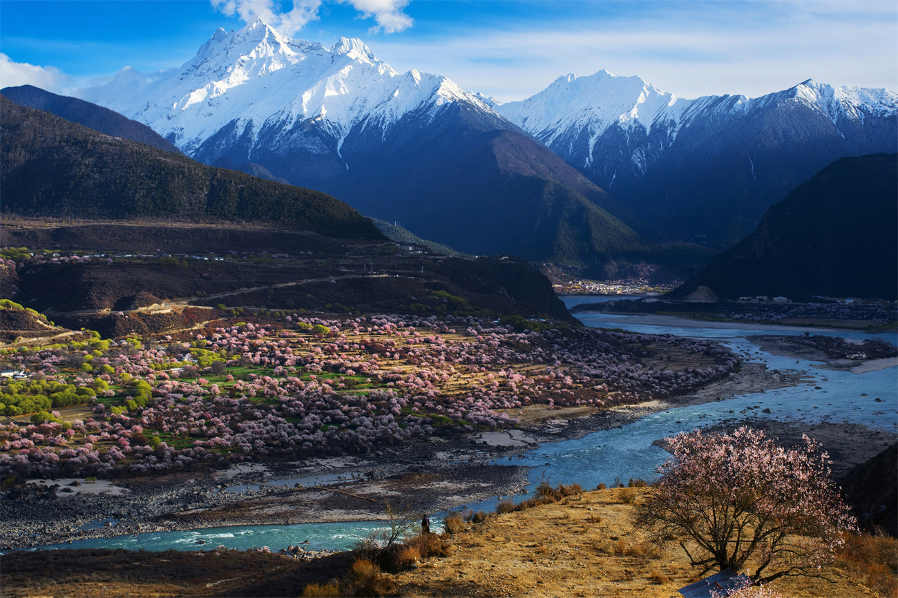
Nestled in Nyingchi City, Xizang Autonomous Region along the lower reaches of the Yarlung Tsangpo River, the canyon stretches from Damukou Village in Mainling Town northward to Baxu Village in Medog County southward, spanning a total length of 504.6 kilometers. With an average depth of 2,268 meters and its maximum depth reaching 6,009 meters, it has been authenticated as the world’s deepest grand canyon.Officially designated by China’s State Council in 1998, it earned national nature reserve accreditation in 2003 and was awarded China’s AAAAA-level scenic spot qualification in 2020. Ranked alongside the Potala Palace and Mount Qomolangma as three world-class signature tourist attractions of Xizang, the canyon carves a striking horseshoe-shaped bend around Namcha Barwa Peak, forming a spectacular natural landscape where towering mountains converge with surging rivers.
Core Index Data
• Full Length: 504.6km (world’s longest canyon of its kind)
• Depth: Average 2,268m, maximum 6,009m (between Namcha Barwa and Ngarla Baimang Peaks, world’s deepest canyon)
• Milestones: Certified as World No.1 Grand Canyon(1994); State Council official naming(1998); National Nature Reserve(2003); National AAAAA Tourist Attraction(2020)
• Landmark: Iconic horseshoe bend encircling the 7,782m-high Namcha Barwa Peak, a globally unique geomorphic wonder.
Formation
Forged collectively by the orogenic uplift of the Himalayan Range and millions of years of fluvial erosion from the Yarlung Tsangpo River.
Water & Atmospheric Channel
It functions as the Qinghai-Xizang Plateau’s largest atmospheric water channel, funneling warm and humid Indian Ocean monsoon inland; annual precipitation in its southern section hits up to 4,000mm, dotted with cascading waterfalls and complicated geological outcrops.
Vertical Climate Zonation
Boasting intact vertical bioclimatic zonation, it features all nine complete vertical natural belts found on Earth, ranging from tropical rainforest up to frigid alpine ice cap, encapsulating a full spectrum of eco-systems from tropical to frigid boreal zones.
Classified as one of the globe’s 34 global biodiversity hotspots:
• Flora: Over 3,700 higher plant species (230 endemic to Xizang), including 509 rare vascular plants and more than 20 state-protected arbor varieties such as keteleeria and taiwania.
• Fauna: 112 mammal species and 45 endemic insect species, alongside rare alpine creatures like alpine musk deer and clouded leopard.
IV. Folk Culture & Human Heritage
Deep within the canyon reside indigenous Zang, Monba, Lhoba and other ethnic communities coexisting in harmony, who have well-preserved exclusive ethnic festivals, traditional dances and primitive lifestyles, cultivating rich and diverse borderland ethnic civilizations.It holds Guinness World Record as “World’s Deepest Canyon” and was named China’s Top Ten Most Beautiful Canyon by China National Geography.
Carved by Himalayan tectonic movements and long-term river erosion into its iconic giant horseshoe bend wrapping Namcha Barwa (China’s most beautiful snow mountain) and Ngarla Baimang Peak, the landform acts as a critical inlet for Indian Ocean warm airflow into the Qinghai-Xizang Plateau. Featuring stark vertical climatic disparity, steep terrain and torrential watercourses, the area abounds in waterfall clusters and distinctive geologic formations.
Home to all nine global vertical natural belts spanning glacial alpine tundra, temperate woodland down to tropical rainforest, it is hailed as the “Gene Pool of Qinghai-Xizang Plateau Alpine Biology”. Covered by primeval forest across 60%–70% of its terrain, it shelters 230 endemic highland plants, 112 mammals and 45 unique insect species; its pristine and complete ecosystem has secured its listing on China’s preliminary candidate roster for World Natural Heritage Site.